

The map of Asia shows the mountain ranges, plateaus and plains of the continent
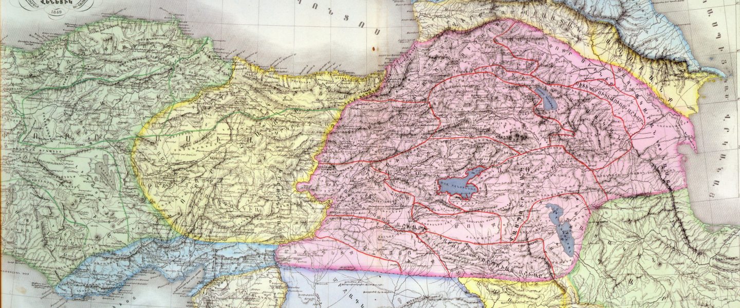
This map is classified as the Orographic Scheme of the Armenian Upland. It is from the textbook titled Soviet Armenia, Moscow, 1971, printed by the Soviet government’s publishing house, Progress Publishers. The small darker shaded area represents Soviet Armenia. The publication classifies the Plateau of Armenia as a “mountainous island” with an area exceeding 300,000 sq. km and maintaining a mean elevation of 1,700m. The zenith of the Plateau is Biblical Mount Ararat placed at 5156m. Important rivers such as the Euphrates, Araxes and the Kura emanate from the Plateau. It possesses two large lakes, Van and Sevan. Climatic conditions dictate the regional population density. The highlands and the Alpine zone dominate the topography, but they are sparsely populated. The vast majority of the population inhabits the valleys and the lowlands – the latter are often situated at the edges of the Plateau – but only form a small proportion of the Plateau’s landmass. H.F.B. Lynche’s book, Armenia: Travels and Studies, published in two volumes in London, 1901, possesses a large pocket map, relevant to physical geography. Although the map ‘Armenia and Adjacent Countries’ takes into account Armenia in its entirety, the volumes only refer to the regions of the country he travelled and studied. Thus, certain key regions are omitted. The provinces travelled, however, are recorded proficiently. Accordingly, the Royal Geographical Society’s comments are most relevant. Details are available in the Geographical Journal, London, vol. XVIII, July-Dec., 1901.
On the other hand, Felix Oswald’s work A Treatise on the Geology of Armenia, published in London, 1906, received excellent appraisals despite the fact that only one of its two volumes covering Western Armenia was published. Further details are available in the Geological Magazine, London, 1906, and the Geographical Journal, London, vol. XXX, July-Dec., 1907.
Հայկական Լեռնաշխարհ The Armenian Highlands Армянское нагорье العربية- المرتفعات الأرمنية , Армянскае нагор’е, Армянскае нагор’е , Арменско плато , Altiplà d’Armènia, Эрмалойн акъари ,Čeština-Arménská_vysočina,Armenisches Hochlandй,Αρμενικά υψίπεδα ,English Armenian Highlands , Esperanto -Armena Altebenaĵo, Español – Altiplano Armenio, Eesti-Armeenia mägismaa — , Euskara-Armeniar goi-ordokia , فارسی سرزمین کوهستانی ارمنستان , Français – Haut-plateau arménien ,עברית רמת ארמניה , हिन्दी आर्मीनिया का पठार , Hrvatski Armenska visoravan , Magyar Örmény-felföld — , Italiano – Altopiano armeno,日本語 -アルメニア高原 , ქართული – სომხეთის მთიანეთი, Қазақша Армения таулы үстірті, 한국어 아르메니아 고원, Lietuvių Armėnijos kalnynas , – Ерменска Висорамнина, Nederlands Armeens Hoogland , Norsk nynorsk Det armenske høglandet , Norsk bokmål Det armenske høylandet , Polski Wyżyna Armeńska , Português Planalto Armênio , Srpskohrvatski / Armenska visoravan ,Simple English Armenian Highland — Simple English, Slovenčina Arménska vysočina, Slovenščina Armensko višavje , srpski, Јерменска висораван й, தமிழ தமிழ ஆர்மேனிய மேட்டுநிலங்கள் ,Татарча/tatarça Әрмән таулыгы , Українська Вірменське нагір’я, Oʻzbekcha/ўзбекча Armaniston togʻligi , Tiếng Việt Sơn nguyên Armenia ,中文 亚美尼亚高原 .

You must be logged in to post a comment.