

The French scholar, Pierre Daniel Huet’s map Terrestrial Paradise, London, 1694. A detail showing Armenia Major/Greater Armenia and Mount Ararat with Noah’s Ark. The Biblical Garden of Eden, on the other hand, additionally classified as Paradise, is also situated within the same geography. The Bible mentions a primary water source intrinsic to the Garden of Eden that parts into four rivers – a testament of decisive importance. Euphrates – emanating from the Plateau of Armenia – is mentioned; the remainder cannot be specifically identified. That Plateau – The Bible’s Sacred Highland – is classified in the Bible as the Land of Ararat. It is the primary source for two major rivers flowing southwards – inclusive of the Tigris – as well as a set of lush rivers flowing eastwards and two flowing westwards. Thus, the Plateau of Armenia amply complies with the four rivers’ precept. Undoubtedly, physical geography requires physical facts. Accordingly, realities demonstrate that the Land of Ararat as a geographically converged superior font – past and present – is the overall noted primary water source that gives rise to the four rivers’ precept. Indeed, the headwaters of major rivers – especially the Euphrates with its major tributaries — emanating from its imposing heights are impressive. In this part of the World there is no equivalent. Some have placed the geographic font in question further south where, however, the requisite constituents – topographic and orographic – are essentially nonexistent.
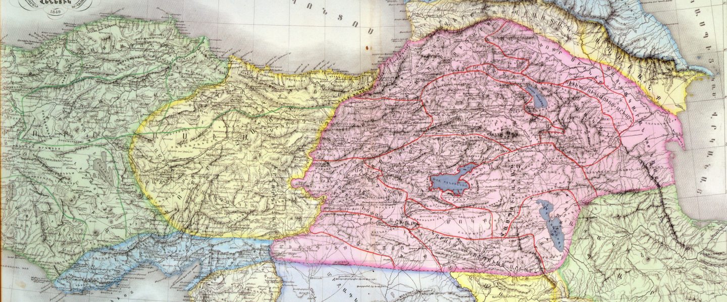
Հայկական Լեռնաշխարհ The Armenian Highlands Армянское нагорье العربية- المرتفعات الأرمنية , Армянскае нагор’е, Армянскае нагор’е , Арменско плато , Altiplà d’Armènia, Эрмалойн акъари ,Čeština-Arménská_vysočina,Armenisches Hochlandй,Αρμενικά υψίπεδα ,English Armenian Highlands , Esperanto -Armena Altebenaĵo, Español – Altiplano Armenio, Eesti-Armeenia mägismaa — , Euskara-Armeniar goi-ordokia , فارسی سرزمین کوهستانی ارمنستان , Français – Haut-plateau arménien ,עברית רמת ארמניה , हिन्दी आर्मीनिया का पठार , Hrvatski Armenska visoravan , Magyar Örmény-felföld — , Italiano – Altopiano armeno,日本語 -アルメニア高原 , ქართული – სომხეთის მთიანეთი, Қазақша Армения таулы үстірті, 한국어 아르메니아 고원, Lietuvių Armėnijos kalnynas , – Ерменска Висорамнина, Nederlands Armeens Hoogland , Norsk nynorsk Det armenske høglandet , Norsk bokmål Det armenske høylandet , Polski Wyżyna Armeńska , Português Planalto Armênio , Srpskohrvatski / Armenska visoravan ,Simple English Armenian Highland — Simple English, Slovenčina Arménska vysočina, Slovenščina Armensko višavje , srpski, Јерменска висораван й, தமிழ தமிழ ஆர்மேனிய மேட்டுநிலங்கள் ,Татарча/tatarça Әрмән таулыгы , Українська Вірменське нагір’я, Oʻzbekcha/ўзбекча Armaniston togʻligi , Tiếng Việt Sơn nguyên Armenia ,中文 亚美尼亚高原 .

You must be logged in to post a comment.